t("co.hero.eyebrow")
t("co.hero.t")
t("co.hero.lede")
Flagship · Special Cross-Borders Project Initiative
Ghana Aviation Academy
The institute's programmes were built for American communities, but the shortage they answer is not an American one. Ghana is the first deployment.
Captain Solomon Quainoo flew Ghana's first Dreamliner into Accra. He has spoken about sharing a room with five others as a boy, and about the cost of a basic licence. Ghana has produced its first female cargo pilot, and a pair of twin sisters who both fly commercially. Each of them arrived by an individual route.
The country does not lack aptitude. It lacks a training pipeline wide enough for the aptitude it already has.
Students begin together in a combined aviation ground school, then separate into an unmanned track and a manned track. Training runs in twelve-month cycles. The first cohort is a hundred students in Accra, and the programme grows in further blocks of a hundred rather than by building a second academy.
Combined ground school
Both tracks start together. Airspace, weather, regulation and navigation.
Unmanned track
Drone and aerial robotics, through to remote pilot certification.
Manned track
Basic through commercial flight training.
Twelve-month cycles
A hundred students in the first Accra cohort, growing in further blocks of a hundred.
Mobile training centres
Simulator labs, classrooms and standby power, relocatable, so training starts before permanent buildings exist.
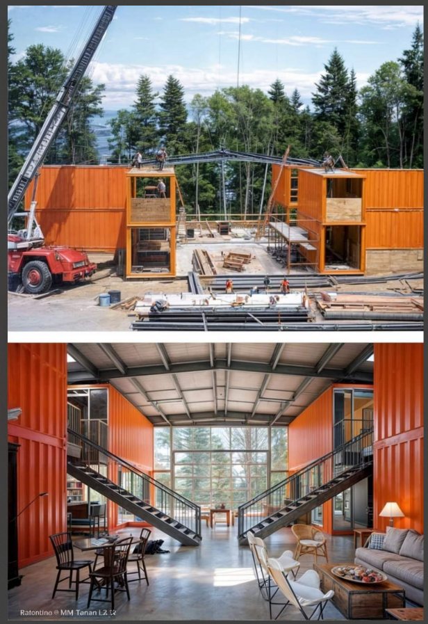
Modular facilities built in Ghana
Campus construction as trade-school work, so the build itself trains people.
Planned for a spring 2027 start. Classrooms and simulators scale with the number of students; airframes do not, and are held as a separate line.
What the work looks like
Drone flyways and flight corridors
Development and testing of drone flyways and flight corridors for review and endorsement by the FAA. Routing uncrewed traffic through airspace that was designed around crewed aircraft is the infrastructure problem underneath everything else.
Long-range surveillance
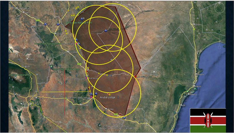
Protection of endangered species, modelled on the Tsavo National Park scenario in Kenya: a standing twenty-four hour operations base, long-range assets on four to twelve hour endurance, mobile interdiction teams and a communications relay.
Flood mapping
Photogrammetry of flood damage along the White Volta, producing a measured surface a district assembly or an insurer can act on, rather than a set of photographs.
Agriculture
Infrared mapping of crop health on smallholder plots, and detection of predators threatening livestock and the people working with them, using infrared coupled with neural-net biological analysis.
Emergency response
Aerial data at an incident, thermal imaging, and trained operators working inside an existing command structure rather than alongside it.
Programme and facility design
Mobile training centres carrying simulator labs, classrooms and standby power, relocatable to any site, so training can begin before permanent buildings exist.
Talk to us about a programme.